Carbon accounting is the basis for carbon pricing and effective carbon neutrality policies in the public and private sectors. Know your footprint, start to act.
Our Collect module records spatially explicit activity data required for land based carbon accounting and GHG efficiency accounting. The tool supports navigation for farm and forest enterprises. In-built plausibility checks enable quality control while in the field. Direct synchronization of the data to a central database prevents information loss.
The Analyze module uses field data, remote sensing and public sources. Combined with analytical models it provides state of the art carbon analytics.
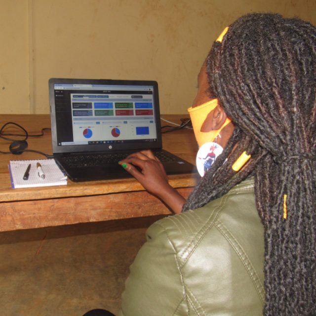
The Monitor & Report module is customizable and displays results in the format most suitable for you. Data can be shown at farm, enterprise or landscape level. WebGIS visualizes the results of monitored land use activities.

How do we do carbon accounting?
We use an App to collect data and a Web-Dashboard to analyze, monitor and report data. The App can be customized for field data collection in any land use context. We combine field data with public sources for spatial analysis, monitoring and cutomized reporting.
Features
- Customized entry mask
- Spatially explicit data collection
- Automated data synchronization on any device
- Comparable with most comman WebGIS software and supports carbon monitoring & analytics
- Integrated models to calculate soil organic carbon changes based on activity data and default values
How we support carbon crediting
Verra and Gold Standard accredited entities use our platform to verify information provided in the standard project documentation (Project Description Document, Monitoring Report). Carbon funds, impact investor and corporates use our digital platform to manage key performance indicators that underpin the carbon asset value.
Features
- Carbon modeling for main carbon pools and emission sources (above and below ground biomass, soil organic carbon, emissions from fertilizer, biomass burning)
- Project boundary map (from farm to landscape level)
- Additionality assessment
- Carbon MRV (measurement, reporting and verification) and asset valuation
- Project level safeguards monitoring, impact reporting
- Data room for project validation and verification